At Advenser, we are pioneers in GeoBIM services, aiming to revolutionize the construction industry with cutting-edge solutions and advanced technologies. With 18 years of proven success, our skilled team is committed to delivering outstanding value by integrating GIS and BIM, boosting project efficiency, decision-making, and visualization. Our in-depth knowledge of both GIS and BIM allows us to provide complete solutions that simplify project workflows and improve collaboration among stakeholders. By leveraging spatial data and 3D modeling, we help our clients optimize their construction projects from the planning stage to execution.
What is GeoBIM?
This method represents a significant leap forward for the construction and infrastructure industries. GeoBIM promotes more sustainable, efficient, and effective project results by harnessing the combined strengths of geospatial and building information. Whether you’re a city planner, architect, engineer, or construction manager, GeoBIM offers the tools to bring your vision to life with greater accuracy and clarity.
3D GIS and Modeling
3D GIS Integration
Spatial Data Analysis
Leverage the power of GIS to analyze and visualize spatial data, enabling informed decision-making in construction projects.
3D Terrain Modeling
Creating detailed 3D terrain models to assess the impact of landscape on construction projects.
Utility Mapping
Accurate mapping of underground utilities to prevent clashes and design interferences during construction.
Site Selection and Planning
Utilize GIS technology to identify optimal construction sites, considering geographical factors and constraints for efficient project planning
3D Modeling Services
Architectural Modeling
Detailed 3D models of buildings and structures to aid in architectural planning and design validation. Immerse yourself in lifelike renderings of your building designs, complete with realistic lighting, textures, and materials. Our 3D models enable architects, developers, and investors to explore design alternatives and make informed decisions before construction begins.
Structural Modeling
Precise 3D models of structural components for analysis and coordination with architectural and MEP systems. Ensure the structural integrity of your buildings with comprehensive analysis and simulation tools. Our 3D models facilitate in-depth structural assessments, allowing engineers to identify potential weak points and optimize designs for maximum safety and efficiency.
4D BIM for Construction Sequencing
Visual representation of construction sequences to optimize project scheduling and logistics. Step into your designs and experience them first-hand with our virtual reality integration services. By transforming 3D models into immersive VR environments, we enable stakeholders to explore and interact with projects in ways never before possible, fostering better communication and collaboration.
Clash Detection and Resolution
Identify and resolve clashes and interferences within the 3D model, minimizing errors during the construction phase. Avoid costly conflicts and delays during construction by detecting clashes between different building elements early in the planning phase. Our clash detection services leverage 3D modeling to identify potential collisions and interferences, enabling proactive resolution before they impact project timelines.
Benefits of GeoBIM:
Enhanced Decision-Making
GeoBIM consolidates geospatial and building information, enhancing decision-making and enabling early identification of potential issues. It provides strategic insights, mitigating risks, and aiding in developing robust project strategies.
Improved Collaboration and Communication
GeoBIM improves teamwork and coordination by providing unified data access, enhancing transparency through clear visualization tools, and streamlining workflows by reducing redundancy and ensuring consistent information.
Increased Efficiency and Productivity
GeoBIM enhances project efficiency by optimizing data collection, analysis, and resource allocation, reducing time, preventing errors, and improving resource management through precise planning and monitoring.
Superior Visualization and Analysis
Enhanced Sustainability and Environmental Management
GeoBIM aids in sustainability by enabling accurate environmental impact assessments, promoting green building practices, energy efficiency, and resource conservation through precise geospatial analysis.
Effective Asset Management and Maintenance
GeoBIM enhances asset management and maintenance efficiency by providing detailed records, predictive maintenance strategies, and accurate information on infrastructure conditions, thereby optimizing operational workflows.
Comprehensive Risk Management
GeoBIM improves risk management by identifying hazards and assessing infrastructure impacts, enabling the design of resilient structures that can withstand challenges, and enhance project resilience.
Building Information Model (BIM)
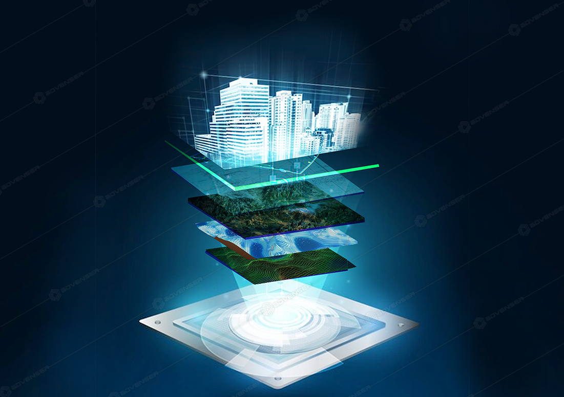
Incorporating geospatial data into Building Information Modeling (BIM) processes revolutionizes urban planning, infrastructure development, facility management, and the creation of smart cities and digital twins. Our comprehensive services under BIM integration with geospatial data encompass:
Integration of Geospatial Data
Our integration of geospatial data service combines cutting-edge technology with strategic insights to optimize decision-making processes across various domains. Leveraging advanced GIS (Geographic Information Systems) techniques, we seamlessly integrate spatial data into existing systems, providing invaluable insights for enhanced planning, analysis, and decision support.
Facility Management and Asset Tracking
Through the fusion of geospatial data and BIM, we streamline facility management and asset tracking processes. Our solutions provide real-time insights into asset locations, conditions, and performance, facilitating efficient maintenance scheduling, resource allocation, and lifecycle management. From buildings to infrastructure assets, we empower organizations to maximize operational efficiency and prolong asset lifespan.
Urban Planning and Infrastructure Development
Our expertise in integrating geospatial data with BIM enables seamless urban planning and infrastructure development. By combining spatial information with detailed building models, we empower decision-makers to visualize and analyze urban landscapes, optimize land use, transportation networks, and utilities, and ensure sustainable and resilient urban development.
Smart Cities and Digital Twins
Leveraging the power of geospatial-BIM integration, we pave the way for smart cities and digital twins. By creating digital replicas of urban environments enriched with geospatial data, we enable stakeholders to simulate, analyze, and optimize urban systems and services. From predicting urban growth patterns to optimizing energy consumption and enhancing emergency response, our solutions drive innovation and sustainability in urban development.
3D GIS: Add Dimension to Your Geospatial Data
Transform decision-making with the clarity of 3D mapping
Data Generation
- Data Sourcing Generate 3D data from existing sources or access ready-to-use content from authoritative sources like ArcGIS Living Atlas of the World and Esri partners.
- Scalable Management Utilize ArcGIS as a scalable 3D system of record to store, manage, and share content across various devices.
3D Analysis Stages
- Advanced Analysis Utilize ArcGIS for advanced three-dimensional analysis, enabling the maximization of geospatial data potential.
- Insight Extraction Leverage deep learning to automate shape and pattern recognition, extracting insights at scale for data-driven decisions.
Data Generation
- 3D Representations Create realistic 3D digital representations to simplify complex issues and effectively convey information to stakeholders.
- Visual Narrative Leverage ArcGIS to craft visual narratives that enhance understanding, encourage collaboration, and establish consensus among stakeholders.
Immersive Experiences & Integration
- Engagement Enhancement Drive deeper engagement and interactions with advanced 3D capabilities and seamless integrations offered by ArcGIS.
- Spatial Exploration Power 3D and XR experiences that enable users to explore and analyze spatial relationships intuitively across various devices, dashboards, and apps.
Project Samples
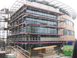
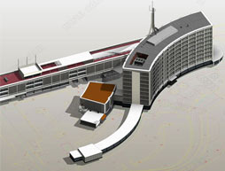
Architectural
Structural
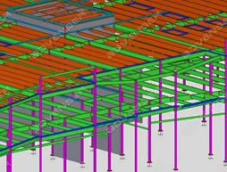
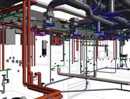
MEP
Facade